This campsite map shows Union Lido around 1970 and offers an insight into the layout of the campsite at the time.
One striking feature is the large, dedicated tent areas, alongside the various pitches reserved exclusively for caravans.
Facilities for guests were already well established. The map identifies, among other things, a supermarket, a bakery and a fruit and vegetable shop.
Other facilities are also marked, along with the extensive beach area directly on the Adriatic coast.
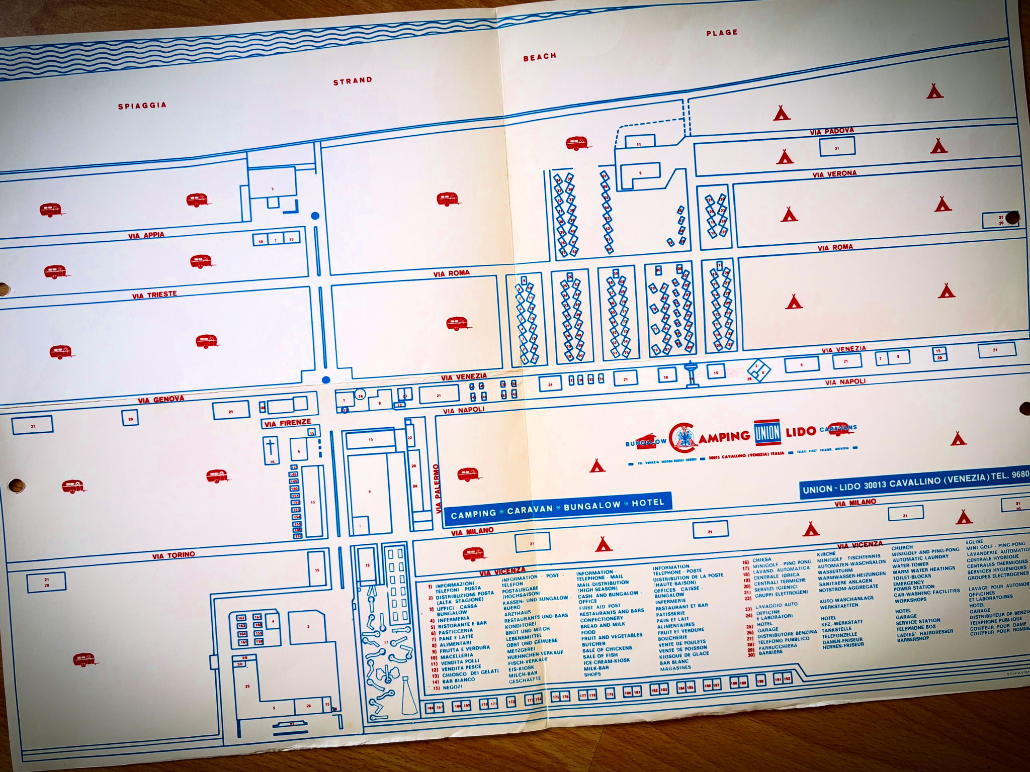
💬What else can you discover on the old campsite map?
👉 Let us know in the post on Instagram↗